Friday, September 21, 2012

Carts and Monomoy

The second refuge that I am stationed at as a Wilderness Fellow is the Monomoy National Wildlife Refuge. It is at the end of the elbow of Cape Cod, MA and consists of North and South Monomoy islands. These islands have converged into a long skinny tear drop that extends into the Atlantic Ocean and Nantucket Sound.  In 1970 they were designated as wilderness except for two small, carved out portions. Unlike my last refuge where the wilderness was a small piece of the refuge’s land and subject to little of the total management activities, most of Monomoy’s attention involves wilderness lands.

Banded juvenile Red Knot. Photo: Deb Harrison

From a biological stand point, Monomoy is for the birds --primarily shore birds although it is also a critical stopover for several migration routes. During this part of the season, piping plovers have fledged, the tern colony disbanded, and Red Knots become the highlight. Red Knots are a medium-sized shorebird with a reddish underside. The American subspecies migrates from sub-Arctic Canada to the Caribbean. The population today has been reduced to one fifth of its previous size, possibly due to habitat disturbance and a decrease in horseshoe crab eggs as a food source. This decline in population size has made research and bird banding more important. For about a week, a small group of biologists and volunteers attempt to band as many Red Knots as possible on the beach.
I was able to fill in one of the volunteer spots for the day. We wake up early in order to completely set up before high tide. We fill one boat with equipment and a second boat with people. The boat ride from the mainland is about 15 minutes to the portion of South Monomoy that we must reach. The boats slow through the shallow water until they can go no further then we unload our equipment to the shore. The equipment necessary for a day of bird banding is more than I can faithfully list; it includes nets, cannons to release the nets, more than a dozen collapsible chairs, a fire box, a tool kit, scopes and tripods and, of course, snacks. We fill our two carts to the brim and carry what’s left. We walk maybe a quarter of a mile through a variation of mudflats, gravel and soft sand when we reach posts with triangular signs. It’s the refuge boundary; past this point we can no longer use our carts.


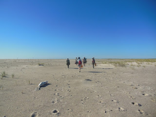
Walking with our equipment. Photo: Deb Harrison

At the outset of the day, the lead biologist explained that we were entering a wilderness area where mechanical transport is prohibited. She said how even if we think using the carts just this once will have no impact it begins a slippery slope in which anything becomes a reasonable excuse to violate the Wilderness Act. I nod along knowledgably. If anyone, it is my role to be the wilderness ambassador.
That was before I learned how much equipment I had to carry for what seemed like a mile, if not more. I’m sure other wilderness fellows and recreationalists would say that hiking a mile in X or Y wilderness is really tough –mountains or subzero temperatures or boggy swamps. I am in no position to say that this walk was tougher, but soft sand works all sorts of mysterious calf muscles, the sun is ablaze and sometimes you’re downwind of a seal carcass. I made this walk six times. My legs feel fine, but my arm muscles burn and hours later I still had three dashes on each of my forearms from the metal bars of the chairs I held. Reaching those carts at the end of the day for that last quarter mile was fantastic.

Furling the net. Photo: Deb Harrison

We set up a net, camouflaging it in the sand, then hide behind the dunes and wait for the Red Knots to arrive. Behind the dunes is our base camp. The shorebirds can’t see us and we can’t see them. A few biologists are stationed with scopes and binoculars. Ever so gently the biologists try to guide the birds to the location in front of the net. It’s called twinkling, which is just funny. It’s amazing how sensitive the flock can be: is that plover in the way? How are the waves falling? Did that peregrine flying overhead just ruin everything? Monitoring the flock lasts for two hours. The biologists tirelessly count birds and give instructions to the twinklers.
Back at basecamp, I rest against my backpack, gaze at the low line of clouds and frankly doze off to the sound of the biologist's instructions over the radio. I rejuvenate myself with candy corn and await the release of the net. Then we would run over the dune, save any birds from the water, distribute them in holding cages and let the banding begin! However, abruptly, the biologist makes the call not to release the nets but pack up instead. It sums up to too many of the birds that we don’t want and not enough Red Knots. When I finally see over the dune, there are hundreds, if not, thousands of sanderlings, and somewhere in there, maybe a dozen Red Knots.

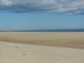
Sanderlings on the shore. Photo: Deb Harrison

It occurs to me while walking back to the boat with the chairs that if any elaborate conspiracy was necessary to get me away for the day, just invite me to join a Red Knot banding project. I will obediently carry the most I can, up and down the beach, then sit behind a dune without even seeing the targeted bird.
The thing is, if they said they needed me to do it again the next day I would have agreed. All the other volunteers were ready for a repeat of the long, tiring, cart-less hike. I think they are on board because they care about the Red Knots (they are now also addicted to finally having a good catch) and they’re willing to do it without the aid of mechanical transport because they believe in wilderness. Why else do people do things the hard way unless they believe in the cause? My arms are sore and as a cruel twist the chairs weren’t necessary because we didn’t have a catch. Still there were moments of complete beauty –seals bobbing in the surf as I walk by, a sweet breeze as I am stretched sleepily in the sand, and the incoming ride with the flat island fringed in beach grass. And we musn't forget this long stretchof land, clear of tire tracks, it is great for the birds. Wilderness designation, while at times challenging to work with, has preserved this beautiful landscape and prime habitat.

Taryn Sudol
Monomoy National Wildlife Refuge
Wilderness Fellow

Saturday, September 15, 2012

Excerpts from an interview with Mark Douglas, Wilderness Fellow at Glacier National Park - September, 2012.

Interview was conducted by Jesse Engebretson, Wilderness Fellow at Saguaro National Park and Chiricahua National Monument.


JE: Overall, how was your experience as a wilderness fellow this summer?

MD: I’ve had a wonderful time being a wilderness fellow. Glacier National Park is an amazing place and I feel lucky to have gotten to spend a summer in the park.I enjoyed working in the Science and Resource Management center and learning about other scientific work going on in Glacier. You know, I really liked developing a relationship with the place and getting to know the area.

                       Mark spending some free time on Lake McDonald, Glacier National Park
JE: What were the biggest challenges you faced?

MD: Deciding on the most meaningful, sensible, and practical measures can be tough. Since a wilderness and the way we steward it are interconnected in a socio-ecological system, it can be tricky selecting a set of components when you see that what relates to one part of the system, feeds back into outcomes you might expect in another part. Fortunately, the agency leaders and past wilderness fellows have been good to keep track of what has worked for better or worse in other cases of wilderness character monitoring. And they provided strong guidance for me navigate those challenges.

JE: Can you talk a little bit about the measure selection process? What did that look like?

MD: Well, first of all, what worked for me in Glacier might not work in every setting with all the differences from protected area to protected area. That said, my approach was to spend about a week looking over park planning documents and past reports to identify where the focus has been and where there was a greater likelihood to keep the momentum going. So, after that, I sat down with the scientific and cultural resource management program manager on one occasion, and the wilderness specialist at another time, and we discussed the feasibility of using different measures and settled on a hopefully indicative and significant set. Throughout the summer some measures were added or removed based on the emergence or lack of appropriate data. I think it was a structured and dynamic process.

JE: How about the narrative? Were there any particular challenges with it?

MD: Yeah, that was definitely one of the greatest challenges. It’s almost a challenge just to describe why it was difficult. But, trying to capture in words the intangible nature of Glacier’s wilderness and then translate those multidimensional meanings into a sensible narrative was daunting. That’s why I began that chapter of the final report with George Grinnell’s quote regarding Glacier: “No words can describe the grandeur and majesty of the mountains, and even photographs seem hopelessly to dwarf and belittle the most impressive peaks.”

JE: What are some memorable things you got to do in the park outside of your role as a wilderness 
fellow?

MD: I have several amazing memories, but I’ll share this one: One afternoon I decided to treat myself to a walk around Avalanche Creek. After a long day of data entry I made the relatively short trip up the Going-to-the-Sun Road to the Avalanche Lake trail head. I had been told that the interpretive signs for the Trail of the Cedars were unique in comparison to what you commonly find on NPS interpretive signs. I started up the trail on the campground side of the creek and quickly found myself enveloped in a Cascadia forest. Big trees, many ferns, moist air, organisms galore. It reminded me of some of my old haunts in the redwoods of northern California. I saw some other folks out enjoying the early evening and crossed the creek. I was making my way down the path when a large old trail blaze caught my eye. For folks that may be unfamiliar, to mark the route of a trail, it had been a common practice to shape and remove some of the bark on trees to make it easier to stay on track if the path became overgrown or covered in snow. So I was looking at the blaze and wondering when it was first marked when I heard a loud twig snap between the trail and the creek. It sounded like it came from a somewhat heavier footfall. I peered through the brush and saw a medium sized black bear foraging about and eating some berries. The bear didn’t see me or at least acknowledge my presence. I watched it for a while and saw the bear make its way over the trail and off into woods. It was just really great to see a bear doing bear stuff and taking its role in the forest. There’s something inspiring to me being in the presence of wildlife. 

Trail of the Cedars interpretative sign, Glacier National Park 
JE: What’s next in the wonderful world of Mark? What are your plans now that you’re done?

MD: Well, I’m beginning the second year of my forestry doctoral program at The University of Montana. I’ll be spending the fall in classes and working on my dissertation proposal. I plan to investigate the role that meanings play in visitor perceptions of and relationships to wilderness in the Boundary Waters Canoe Area. I’m also working as a research assistant to my advisor, Dr. Bill Borrie, helping him investigate visitor travel patterns in that same wilderness area. More of the same in the spring, next summer, I will be collecting data for both efforts in that north woods canoe country. After that, I’ll finish the PhD and look for more opportunities on the horizon.

Tuesday, August 7, 2012

War on the Refuge


One of the things that makes the Alaska Maritime National Wildlife Refuge so unique is that it is the only place in all of the United States on which a land battle was fought during WWII. In fact, it is the only place in the United States where any battle has been fought on refuge land!

Preparing for battle in the Aleutian islands.

The Aleutian Islands Refuge was established in 1913. In 1942, war broke out on these islands as the U.S. military fought off Japanese occupation of Kiska and Attu Islands – about as far west as you can get and still be on U.S. soil. In 1980, most of the Aleutian Island Refuge was designated as wilderness and combined with 11 other coastal Alaskan refuges to make the Alaska Maritime National Wildlife Refuge.  Today, the remnants of war remain in impeccable condition. Thanks to the extreme isolation and climate in this region, the military ordnance laid to waste throughout the refuge is said to be one of the best preserved WWII battle sites in the entire world.

This battlefield-refuge interaction has some very complex implications for wilderness character. How do you balance the immediate costs with the long term benefits of removing hazardous wastes that were left behind from the war when you consider the manpower, machinery and potential environmental destruction required to do so? What does the evidence of human history in a place as remote as the Aleutian Islands do for your sense of solitude? Some might argue that a dilapidated Quonset hut and abandoned artillery are cultural resources; that these things provoke thought about the sovereignty of the untamed wild. On the other hand, historical military access routes certainly degrade the opportunity for primitive recreation. 

In some ways the battlefield adds a captivating third dimension to maritime Alaskan wilderness. However, it is at the same time a serious headache for wilderness managers.  


Military artillery in the wilderness of Kiska Island (Photo Credit: Jeff Williams, 2007)


Kelly Pippins
Alaska Maritime National Wildlife Refuge
Wilderness Fellow 2012

Friday, July 20, 2012

Engaging cultured wilderness


"The desire to categorize what lies beyond the boundary of civilization must be resisted because only insofar as we can encounter untamed wildness, that which is other than civilization, can we understand what it means to be civilized." --Michael Zimmerman


Let me begin this post by stating that the waters in which I wade here are murky at best and opaque at worst. Whole academic programs are devoted to the topic of wilderness and civilization. That stated, let's take a glance at the intersection of wilderness and civilization through the lens of cultural resources at Glacier National Park.


As a wilderness fellow, I'm expected to develop measures for the five qualities of wilderness character. So far I've developed a pretty good grip of measures. I've even got a couple for cultural and archeological resources. In tracking down the conditional statuses of the historically classified structures found in Glacier I came across an anomaly when I was cross referencing the cultural resources data with facility management data. I found a structure of historical significance that didn't show up on the park's GIS layer of buildings or in its building inventory.


The gaging station was built in 1949 as a means to supplement information about glacier variation. M.J. Elrod took the first measurements to track the glacier's recession from 1925 - 1927. He paced the distance from a specific boulder to the ice edge. George Ruhle continued the measurements until 1937 when more accurate mapping began.


In 1945 the USGS took over the glacial studies. A precipitation storage gage was put in nearer the glacier the same year the gaging station was erected. The two facilitated correlative investigations among precipitation, runoff, and glacier size variables. The gaging station was functional until 1978. Migration of the creek channel left the station removed from the stream and it was abandoned, but not removed. Some have argued that it should be removed because it sits in recommended wilderness. Maybe.


There has been a disconnect between cultural resource folks and wilderness folks in the park service. There has been persistent confusion and misunderstanding that cultural resource management and wilderness stewardship are incompatible. I'd like to highlight one of the emerging principles relating wilderness and cultural resources.


"Cultural resources can benefit wilderness areas by allowing visitors to understand and feel connected to the vital and varied relationships between people and nature" (NPS Draft Wilderness Character User Guide).


I don't know what another visitor might feel if they came across the gaging station. I know that my curiosity level surged when I discovered the discrepancy between GIS data and cultural resource inventory. I imagine that if I encountered the station while exploring the wilderness I would feel bewildered and wonder what purpose it had served. I might ponder the relationship between people and nature.


I now feel more connected to the park having gotten to the bottom of the gaging station situation. I have insight to the human-glacier relationship. The orientational quote beginning this post mentions encountering "untamed wildness" and I see the gaging station situation as a wonderful example of untamed wildness. The quote also mentions "the boundary of civilization" and I see this as a case of nested boundaries.


Despite the efforts and surveillance of the USGS, the meandering nature of a mountain stream demonstrates the inability of humanity to keep perpetual tabs on primal riparian flows. When we try to get a grip we often find that we've only scratched the surface. We go back to the drawing board for a new design. To me, this shows how people are part of the natural process. To me, we are not just surveyors of the scene. There is much to be gained from careful observation. The balance goes to integration. The space between the stream bed and the structure accounts for this relationship.


Wilderness is paradoxical and it allows us to question boundaries and the line between nature and culture. Where does wilderness end and human nature begin?


Mark Douglas
Glacier National Park 
Wilderness Fellow 2012

Saturday, July 14, 2012

Loosening your grip in the wilderness


As I sat at the edge of the tide, I thought about collecting and letting go.

The Chincoteague National Wildlife Refuge (NWR) is located on the Virginia portion of the Assateague barrier island. There’s a trail that ends at the Atlantic seashore in northern Virginia. It is accessible by foot or bike but not by car. It is littered with seashells. I didn’t come here to beach comb but as I walked along a few shells caught my eye. I pick up black, amber, and deep amethyst colored bits. I sit at the wave’s break line and let the seawater rinse the sand off the shells. The waves push and pull the sand around my legs. I know if I loosen my grip just a little my small collection will tumble from my hand and disappear.

                                            Decorated Driftwood on Chincoteague NWR

It’s within my first week as a Wilderness Fellow that I sit on the beach debating whether to take a souvenir. What has already become the defining characteristic of the Assateague barrier island is dynamism. The island has existed for thousands of years but has only survived by constantly changing form.  It boils down to the sun, moon, and our irregularly shaped planet. The tides and littoral drift push and pull sand so that the island migrates –usually south and inland. Sometimes the island's migration is accelerated by storms and sea level rise or interrupted with seawalls and jetties. The islands, like anything really, are always responsive. A seawall or jetty deprives a different part of the island or a separate island of a sediment source. Starved, the island may contort more rapidly or ultimately thin and wash away.

People put seawalls and jetties on the shore in an effort to stabilize what is there. It seems that they want to hold onto what they’ve grown accustomed to. They’ve become invested in the landscape as it is, invested maybe through commerce, real estate, or memories. One of the biggest management issues the Chincoteague NWR faces is trying to maintain its current location for beach-access parking. The parking lot in place is continually overwashed with sand. The solution would appear to be moving the parking lot back or rebuilding it. The refuge has done so multiple times at considerable cost. Now, because the island is thinning, the parking lot is being squeezed out.

My first reaction is to abandon the parking lot and let the beach do what it wants. My favorite thing about the beach is that it’s never the same. You can’t come to the same beach twice. The waves crash in a slightly different pattern and therefore tug the sand into new contours. The weather can cause the ocean to be steely and powerful or glittering and playful. The sea foam can be so fluffy that it rolls in the wind or instantly dissolve with a hiss into the sand. As a local pointed out to me, the only thing constant about a beach is change. How can we ever capture it? The beach will consume the parking lots or tear down the houses at the edge or become something completely different from what you saw in your childhood.

Parts of the refuge are intended for recreation and thus the battle of the parking lot. But the northern part of the refuge is proposed wilderness where the intention is to let natural forces reign. Wildernesses usually have the inaccurate reputation of being pristine. To me, pristine is closely associated with unchanged. Yet the proposed wilderness for the Chincoteague NWR will embrace change. The only permanence about the wildernesses is ensuring that natural forces are allowed to occur without restraint. I feel that sense of release knowing that the wind and waves may push the sand where it likes in the northern Chinctoeague NWR. Whenever I may visit, I will know it for that one day but even then I’m letting it go and when I return it will be new again. 

Taryn Sudol
Chincoteague National Wildlife Refuge
Wilderness Fellow 2012

Thursday, July 5, 2012

First Impressions

The Alaska Maritime National Wildlife Refuge (AMNWR) is arguably one of the most remarkable expanses of federally protected land in the United States. Extending nearly as far and wide as the contiguous lower 48, this refuge comprises most of Alaska’s islands, islets, emerging rocks and spires from Forrester Island in southeastern Alaska to the western reaches of the Aleutian Chain and about as far north as Barrow in the Arctic Circle. These land masses are home as many as 40 million nesting seabirds every year and provide a means of respite for other birds migrating between North America and Asia. Making up the northern-most ridge of the Pacific Ring of Fire, the Aleutian Island Chain is one of the more well-known units of this refuge. That is not to say however, that any of the other 4 units are any less spectacular. Beginning in 1970, hundreds of acres of land within each of these refuge units were congressionally designated as wilderness. As the wilderness fellow for the AMNWR, it is my primary task to complete a wilderness character assessment of these areas.

Prior to our first week’s training, I knew next to nothing about the “wilderness,” let alone the wildernesses of Alaska. Now, with only 3 weeks of work under my belt, I can confidently explain that congressionally designated wilderness areas are inherently complex. What does it mean to preserve and protect land in its natural condition? How do we define natural condition? Can nature be natural if we are constantly protecting it from change? How do you differentiate natural change from anthropogenic impacts? These kinds of questions plague every environmentalist. It is up to the FWS, NPS, FS and BLM to select the best possible answers for our nation’s wilderness areas according to the best available information. Ideally, the work of a Wilderness Fellow will help guide these agencies toward lawful and logical conclusions.

Unfortunately, I cannot yet claim to have ventured out to the vast wilderness of AMNWR, but my research thus far and personal reports from the refuge staff have me wriggling in my boots to do so. Until my time on the Tiglax (AMNWR’s research vessel and life support system for field camps) in early August, I write from a second hand point of view. From here, I can see that the wildernesses of AMNWR are not only ecologically, geographically and culturally diverse in and amongst themselves, but they are also incredibly unique compared to wildernesses throughout the United States. In the lower 48, it is relatively easy to enjoy a wilderness area first hand. In maritime Alaska, visitor access to the wilderness is limited. Without a boat or plane (and a seriously adventurous attitude), these islands are virtually inaccessible. Rather than visitor use issues, this refuge faces issues regarding subsistence use by native communities, marine debris, and military refuse from WWII. My work here has clearly just begun.

Kelly Pippins
Alaska Maritime National Wildlife Refuge
Wilderness Fellow 2012

Finding Value in the Inaccessible Reaches of Wilderness


Coming up Highway 40 from Colorado most people visiting the “on the way out of the way” Dinosaur National Monument will experience it in one of two ways; the first being to view the multitude of Jurassic era dinosaur bones found in the Quarry. The second being the permitted few who are lucky enough to enjoy a rafting adventure down the Green or Yampa Rivers. Both of these options, albeit starkly different, offer the visitor scenic views, educational experiences, and incomparable opportunities for recreation within the Monument. Yet both options are intentionally and decidedly predictable, directing visitors to known vistas or fossils and removing the challenge of personal exploration.

While the often rafted Green and Yampa Rivers certainly constitute as wilderness and rowing a raft is nothing to belittle, once one leaves the sight of water you face a much more taxing and self-reliant experience. There are no intricate trail systems here that visitors can trek to reach the highest pinnacles jutting above the horizon; and except for two dirt roads in and out of the park and the river system, somewhat limited access for those who prefer hiking on trails. Negotiating any significant portion of the dry, rocky, cactus laden, piƱon juniper landscape off-trail becomes a bushwhacker’s nightmare. 

Prickly Pear Cactus Blooms (Photo Courtesy: Sarah Crump)
Herein lays my unique challenge in acting as the Wilderness Fellow at Dinosaur. I am faced with writing about the seemingly less-intriguing, yet expansive middle space of the park, the undiscovered and seldom ventured landscape that lies between the river corridors and the Monument boundaries. The wilderness. How do I attempt to analyze and confer the value of an area that is managed as wilderness, unbeknownst to most visitors, and that is not only physically inaccessible to me, but is inaccessible to its would be stewards and protectors?

This inaccessibility it turns out is part of the intrigue and definition of the Dinosaur wilderness and all wildernesses for that matter. Its remoteness and detachment lends to its character and quality of solitude. The fact that I can’t experience all of it in the conventional way of hiking along a known route makes it all the more imperative to preserve this space.  Knowing places like Pearl Park, Martha’s Peak, and Limestone Ridge exist, yet are located just out of reach for the everyday visitor gives me solace.  Areas like this don’t exist for you or I, but instead hold intrinsic worth in being left alone. “The middle of the park is mine; it is my playground,” exclaimed one individual who pours his heart into working for Dinosaur. Defending this area from the encroachment of park roads, visible trails, and from use as domestic rangeland has been a battle since before the Monument was expanded in 1938.  


Although the technical status of this area is held in a Congressional limbo, it is proclaimed “Recommended Wilderness” by the National Park Service and it is managed as if it were Designated Wilderness in order to preserve its wilderness character.  Simply because this area of the wilderness cannot be experienced from an overlook or river raft makes it no less valuable and in fact increases its importance tenfold. Bringing attention to the idea that this area of the wilderness deserves respect because of its inaccessibility will continue to be a grueling contest, but it is a worthy task with treasured rewards.


Yampa River from Warm Springs Cliff (Photo Courtesy: Sarah Crump)


Sarah V. Crump
Dinosaur National Monument
Wilderness Fellow 2012